
Trace Tulsa Street Directory Parcels
The useful method follows public property records one parcel at a time. Begin with the Tulsa County Assessor Property Search, using only enough of the street or address to obtain a workable result set. The office advises that less is more. Select the correct situs address, which is the physical parcel used for assessment, and copy its account number, parcel ID, legal description, current owner, owner mailing address, and Sales/Documents entries. An owner mailing address is a tax-correspondence field. It can be away from the parcel and does not establish who is physically present at either address.
Keep this address search focused on what the records actually show. The assessor identifies a current assessment account, not a legal title conclusion or a current-person roster. Its document pointers provide the handoff to recorded instruments, while the City map helps confirm the address location. The voter portal is only an individual self-verification service with an exact first name, last name, and date of birth. It does not browse a street. For a historic printed name at an address, the Central Library's reverse and cross-reference books are the appropriate next source.
- Search the street or address in the Assessor portal and select the matching situs entry. Save the account number, parcel ID, legal description, and the Sales/Documents fields.
- Use the City GIS locator to place the address and inspect nearby parcel shapes. Treat the map as navigation, then verify each parcel separately in the Assessor record.
- Carry the sale date, grantor, grantee, deed type, and document number into the County Clerk path. Those fields connect an assessment entry to a recorded instrument.
- Use the legal description or parcel details in Acclaim when the recorded-document search needs them. For earlier material, switch to the Clerk's historical products, counter help, or a targeted request.
- For a past street listing, consult the library's reverse directories after 1912 or Cross Reference Directories after 1944, and record the directory year with every name.
Note: A street sequence can establish parcel and document context, but it cannot reliably identify every person who occupies an address.
Tulsa Address Search Fields
The assessor's one-box search accepts an address, account number, subdivision, or owner name. Start broad, then use the column filters after results load. Exact quotation marks can hold a phrase together; a minus term removes unwanted results. The office warns that periods, commas, and apostrophes may interfere with a match. This makes the official tool well suited to a named street segment, provided each returned parcel is checked before it is treated as the intended address.
| Assessor field or control | Use in a Tulsa street search | Format note |
|---|---|---|
| All selector | Sets the inspected public search mode | The visible selector is labeled All. |
| Address, account, subdivision, or owner | Runs the initial flexible query | Use an address, quoted subdivision, owner name, or R-prefixed account. |
| Column filters | Narrows a broad result set | Available after results load. |
| Quoted term and minus term | Controls matching and exclusions | Quoted text is exact; a leading minus excludes. |
For a close view of the fields that a street-directory search can produce, the official sample parcel card is shown below.
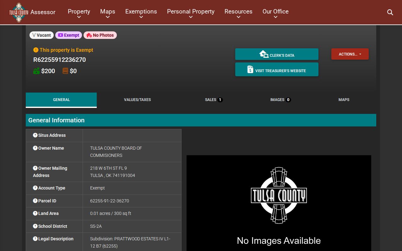
The card separates the situs from the mailing address and shows assessment, exemption, and Sales/Documents information, useful distinctions before continuing an address search.
Tulsa Address Record Layers
Address-keyed sources in Tulsa answer different questions. The parcel card establishes the assessed property; a recorded instrument documents a transaction; a permit can date work; and a reverse directory can place a published name at an address in one year. No single layer replaces the others. The County Treasurer can provide tax-account and receipt context, but tax status is not an identity finding. Start with the parcel and retain the same account, legal-description, and document details as the research moves between offices.
| Tulsa street record | Custodian | Address connection | Access path |
|---|---|---|---|
| Assessor parcel card | Tulsa County Assessor | Situs, owner, mailing address, parcel, values, and sales pointers | Free portal, counter, or data request |
| Recorded instrument | Tulsa County Clerk | Parties, document number, type, date, and legal description | Acclaim, historical route, counter, or request |
| Tax account | Tulsa County Treasurer | Payment, receipt, and tax-bill context | Online tax-information route or office |
| Permit or inspection | City Development Services | Address-linked work and available documents | Guest CSS search or Permit Center |
| Reverse directory | Tulsa City-County Library | Printed historical address-to-name connection | Research Center collections |
When the public screen does not answer an assessment or map question, the Assessor’s counter is on the fifth floor of Tulsa County Headquarters, 218 W. Sixth St. The office lists 918-596-5100 and Assessor-DataRequest@tulsacounty.org. Its reproduction policy permits requests for maps, information, reports, and available building images during business hours; data may be supplied by download link or USB when available.
The Tulsa County SmartGov public portal also provides a public parcel-search entry point.
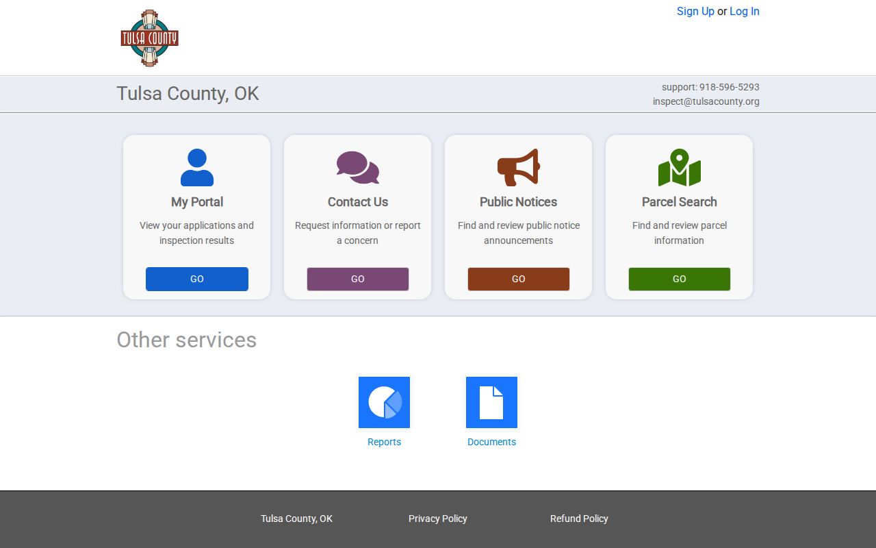
Use it as a routing point for a parcel-related task, then preserve the official parcel identifiers before moving between these public record sources.
Read Tulsa Address Keys Correctly
A street number is only one key. The situs address is the assessor's physical parcel address. A legal description is the land locator used in recorded-property work, often a lot, block, and subdivision description or section-township-range language. A parcel ID is the county's property identifier. A criss-cross directory is a published book organized from address to name, rather than from name to address. Keeping those keys distinct prevents a search from drifting from a current parcel into an unrelated mail destination or an older published listing.
- Parcel
- A defined piece of land in the assessment system, identified by a county account or parcel ID.
- Situs address
- The physical address assigned to the assessed property, not necessarily the owner's correspondence address.
- Legal description
- The formal land description used to link a parcel to plats and recorded instruments.
- Criss-cross directory
- A historical directory arranged to find the printed name associated with a street address in a specific year.
That distinction is especially important where a property card shows a mailing address far from Tulsa. It is evidence about where the county sends tax mail, not proof of a person’s present location. The same caution applies to exemption rows. They are assessment fields and should never be converted into a household list.
Take a Tulsa Address Lead to the Clerk
The property card's Sales/Documents table is the practical bridge from a street address to recorded land material. It can show a sale date, grantor, grantee, sale price, deed type, and instrument number. Carry those labels exactly into the Tulsa County Clerk's Acclaim system. Parcel search accepts a legal parcel number, with optional document type and recording-date range. The portal supports Starts With, Contains, and Exact matching. Its public-facing County material describes a registered, fee-based route, so an account gate is a normal access condition rather than a missing record.
The important comparison is coverage. Tulsa County says the name index starts in 1928, while legal-description indexing starts in 1987. Older work may require a party-name search, book or tract research, the Historical Camera images, or help at the Clerk's counter. The image below shows the County Clerk grantor-grantee search route.
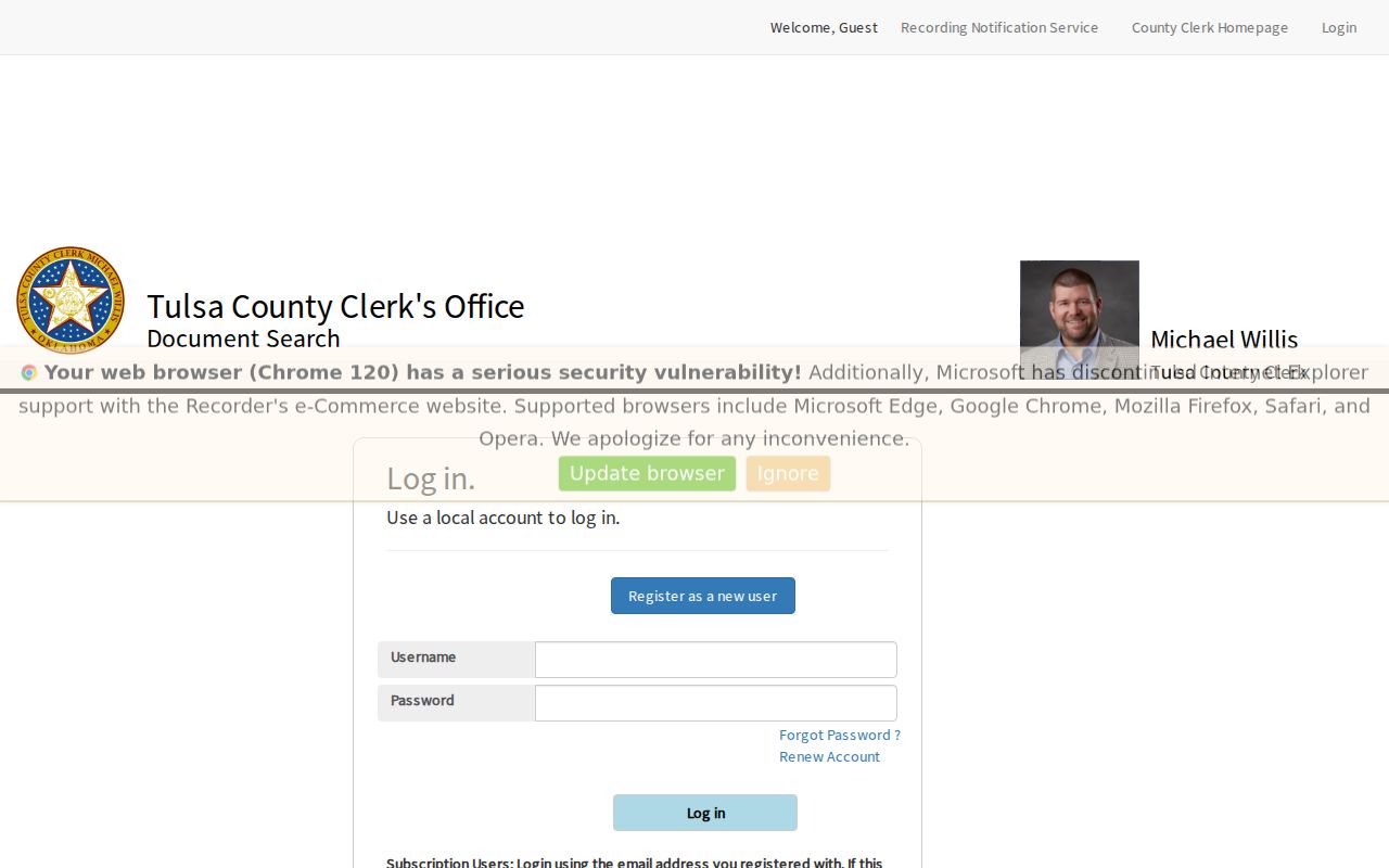
Names, instrument numbers, and recording dates should be copied carefully. An address alone is often not the best search key for a historical recorded instrument.
Tulsa Recorder Coverage Has Two Cutoffs
The 1928 name-index and 1987 legal-description-index split is a real Tulsa address-record limitation, not a reason to assume the trail ends. The County Clerk provides separate historical-camera, tract, and plat paths. The Historical Camera screen requires acknowledgement that the records are for informational and private purposes and that derived index information cannot be sold. When an online search, account access, or image availability does not answer the question, call the land-records line at 918-596-5801, selection 3, write landrecords@tulsacounty.org, visit the Clerk, or make a targeted county open-records request.
The Historical Camera Records acknowledgement page is shown below.
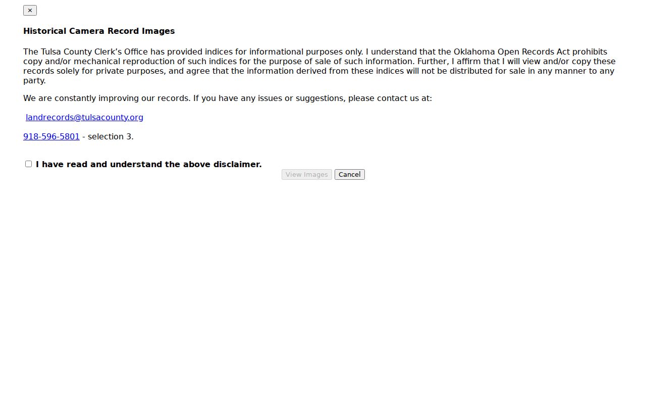
For a record before the web index reaches, this separate historical path or the Clerk's direct assistance is more reliable than trying to force a modern address into an incomplete search field.
Use Tulsa GIS for Street Navigation
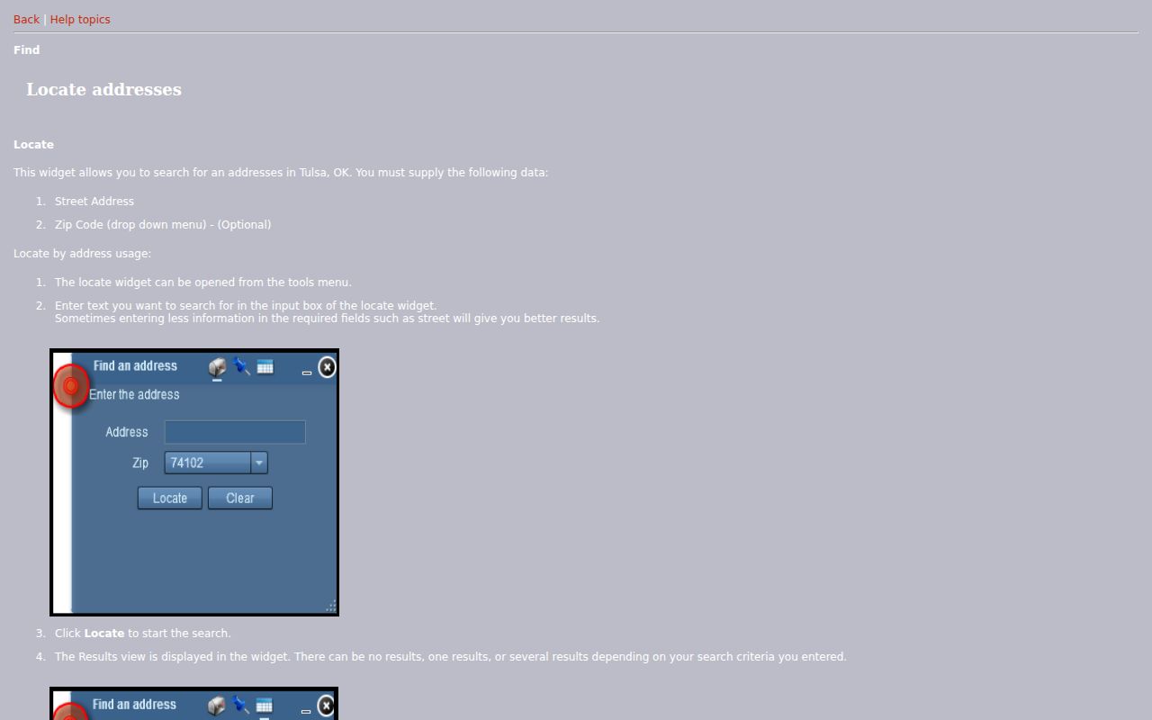
The City GIS locator helps put a street search result in the correct map position. Its documented fields are Street Address, an optional ZIP Code selector, and optional coordinates. A search can return no, one, or several matches with a match score; selecting a result zooms the map. The help also describes basic and advanced search tools, layers, printing, bookmarks, and an overview map. Enter less of an address when necessary, then choose the correct result rather than treating the first match as certain.
The City’s GIS locator instructions appear here.
Visible parcel shapes can guide a street-by-street check, but the inspected City materials do not document an authoritative one-click neighbor result or public radius export. Verify each parcel in the Assessor record.
Tulsa Address Permit Records
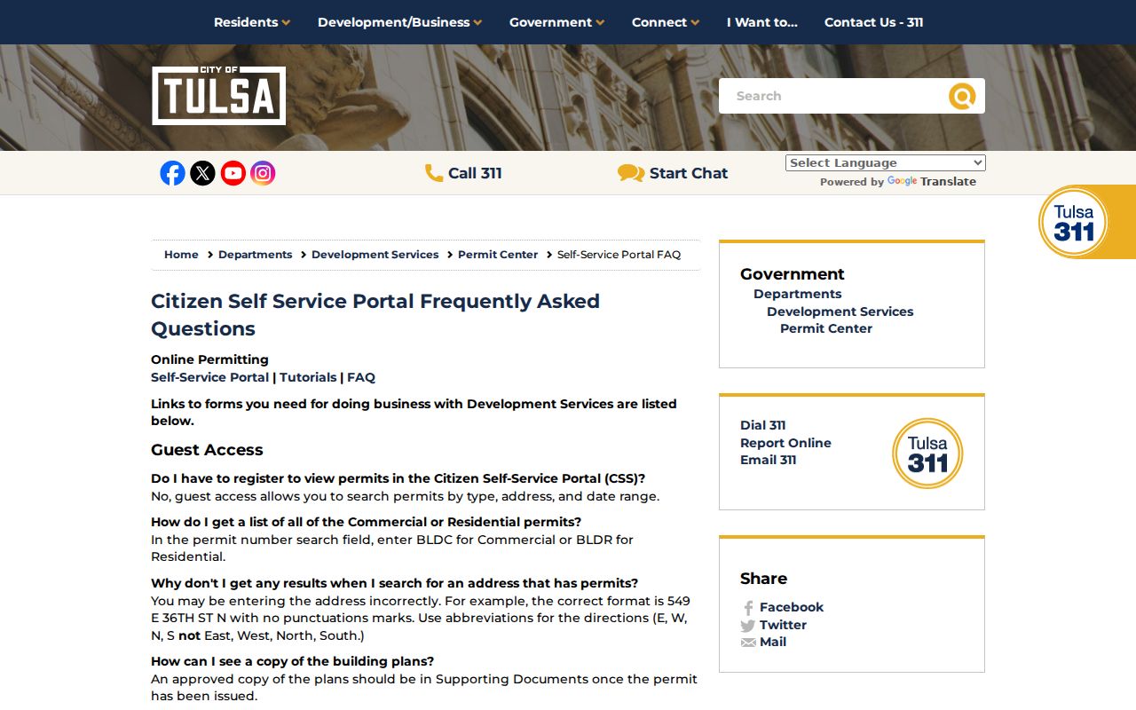
City Development Services CSS adds a second address-indexed trail. Guest users may search permits by type, address, and date range. The address syntax is strict: number, abbreviated direction, street, and suffix without punctuation. Research results can include permit status and related documents, and issued permits may have approved plans in Supporting Documents. A permit can place construction or alteration activity in time. It does not prove who was present at the address, and an unissued application should not be presented as completed work.
The City permit guest-search guidance is shown below.
If a requested document is not in CSS, the Permit Center at 175 E. 2nd St., fourth floor, conducts public-record searches. Its listed phone is 918-596-9456 and weekday hours are 8 a.m. to 4 p.m.
Tulsa Reverse Directory Books
For historical work, leave the current parcel chain and use the Tulsa City-County Library's published collections. City directories run from 1909 to the present with stated gaps in 1945, 1949, 1952, 1962, and 1998. Reverse street access begins in 1912, and Cross Reference Directories begin in 1944. A printed entry may preserve a name, spouse notation, occupation, and address for one publication year. It does not identify every person connected to that address or settle a present-day question.
The Central Library directory resources offer the local collection route. The historical shelf is treated in more depth in the Tulsa city directory collections, while the present street-by-street parcel chain remains the better tool for current property context.
Tulsa Street Grid Quirk
Tulsa's street system has a local continuity trap. The townsite was surveyed in 1901 with the Frisco Railroad tracks as the downtown north-south divide and Main Street as the east-west divide. Later planning added different systems, and the city has an unusual intersection of 11th Street East and 11th Street East. A 1908 resurvey tied to a new charter led to an ordinance changing some original street names and numbers. North Tulsa and areas beyond Sheridan Road brought further naming changes.
When an early directory address does not resemble a current result, compare the publication-year directory with a period plat or City map before deciding the address vanished. Admiral Boulevard, for example, was formerly Federal Boulevard. The Tulsa Library street-history FAQ explains the grid and naming patterns. This comparison is the sounder approach for an old address.
Note: Postal ZIP, legal description, and historic street name are separate address keys, so none should substitute automatically for another.
Limits of Tulsa Address Records
Tulsa address records can show public property, document, permit, map, and dated directory evidence. They cannot produce a complete list of people at an address. The reviewed sources do not offer a public voter roster by street, motor-vehicle address records, utility customer records, or protected voter addresses. The OK Voter Portal requires a specific registered name and date of birth, and its absence of a match does not prove a person is unregistered. Oklahoma's Restricted Records Program and Address Confidentiality Program also protect eligible voter information.
For a direct records question, the Tulsa County Election Board can explain its access route, while the Oklahoma Election Board record notice describes the protected fields and available channels. A non-result should remain a non-result, not a conclusion about a person.